The Zuni Sandstone is complicated.
A good reference for the Zuni is:
Maxwell, Charles H., 1982, Mesozoic stratigraphy of the Laguna-Grants region, in Wells, S. G.; Grambling, J. A.; Callender, J. F.; [eds.], Albuquerque Country II, New Mexico Geological Society Fall Field Conference Guidebook, no. 33, pp. 26-265.
According to Maxwell, all the overlying Jurassic Morrison Formation that is so prominent along I-40 east of Grants, NM is truncated and the Cretaceous Dakota Fm lies directly on the Jurassic Zuni. The Zuni overlies and interfingers with the underlying Jurassic Bluff Sandstone that is so prominent along I-40 between Mesita and Laguna with numerous sandstone pipes.
Another useful reference is:
Anderson, Orin J., 1983, What is the Zuni Sandstone Today -- 100 Years After Dutton? A discussion and Review of Jurassic Stratigraphy in West-Central New Mexico, New Mexico Bureau of Mines and Mineral Resources, Open-File Report 174, pp. 40.
Anderson summarizes:
"While it is recognized
that the in - field distinction between the two largely eolian units - the Entrada
and Cow Springs - will be difficult and not always practical, the name Zuni
Sandstone shall be applied to the undivided equivalents of the Entrada Sandstone
and the Cow Springs Sandstone south of the Summerville-Todilto pinchouts
in the Gallup Sag-Zuni Basin area and eastward as appropriate into the Acoma
Basin. This usage corresponds to the original
use of the term "Zuni sandstones" in this area only. Northward and eastward
the Cow Springs Sandstone rests on younger San Rafael formations, the Summerville
and the Bluff, and is more easily distinguished from them. Although there
are problems locally in recognizing the Bluff and Cow Springs as separate
units, this does not justify usage of the term Zuni outside the specified
area.
Anderson presents a useful correlation diagram that you may appreciate.
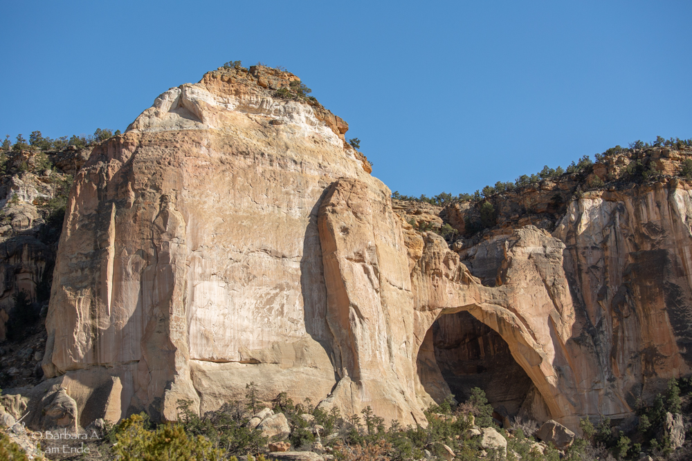
At El Malpais National Monument, New Mexico, the USGS maps the Sandstone Bluffs and the cliff in which La Ventana Arch is formed as the Jurassic Zuni Sandstone. In the picture below, you can see an irregular bleached area near the top, just under the darker, less massive, Cretaceous Dakota Formation.
|