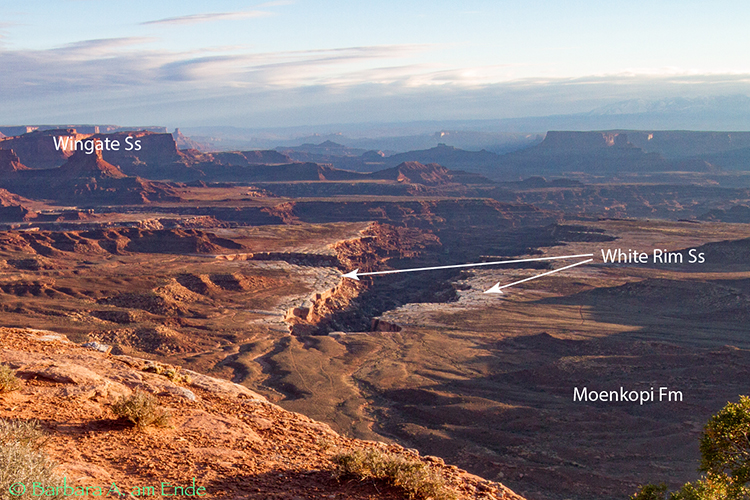
The White Rim Sandstone is a major feature of the Island in the Sky part of Canyonlands National Park. It's a resistant sandstone, white in color of course, that forms a prominent bench above the Colorado and Green Rivers. There's a 100 mile long 4WD road, the White Rim Road, that traverses the ledge with fabulous views.
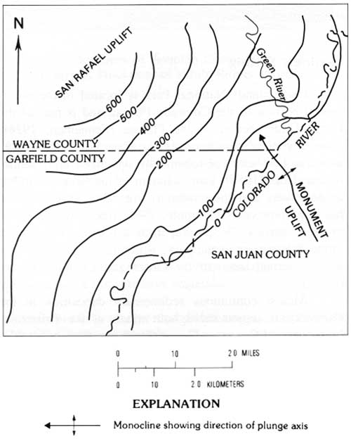
As characteristic as this unit is at Island in the Sky, I was so perplexed about why I didn't see it at the Needles. There were white sandstones, but clearly not "THE White Rim." I also knew how the undifferentiated Cutler beds (e.g., Fisher Towers) were shed off the Uncomphagre uplift to the east and were correlated with differentiated Permian beds to the southwest (e.g., Cedar Mesa Sandstone). Shouldn't the White Rim be located there, too? Well, it turns out the source of the White Rim Ss is the San Rafael Swell to the west. I'll have to do more reading to understand all the provenance, etc, but at least it explains the stratigraphy. The figure below is from Steele (1984). It is an isopach map showing how the White Rim pinches out pretty much right along the Colorado River. No White Rim at the Needles.
Steele, Brenda A., 1984, Depositional Environments of the White Rim Sandstone Member of the Permian Cutler Formation, Canyonland National Park, Utah: US Geological Survey Bulletin 1592, 20 pp.
|