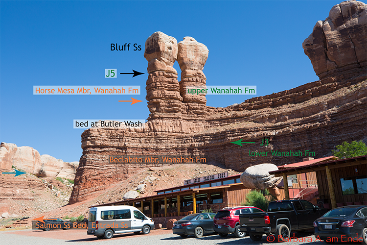
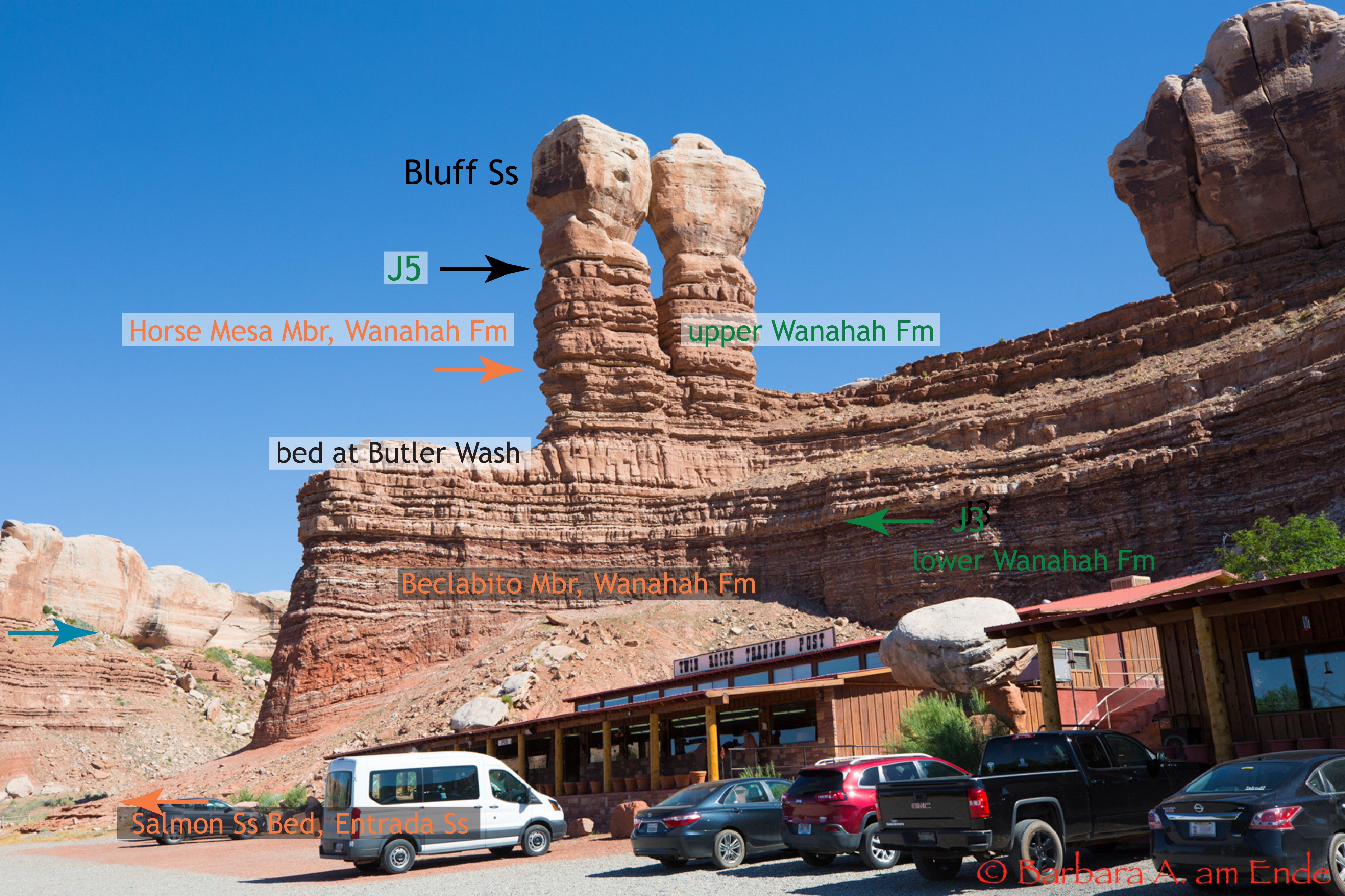
The Bluff Sandstone is sometimes tricky because of the bed at Butler Wash looks a lot like the Bluff itself, at least to me. Gregory (1938) described the Bluff Sandstone as the basal member of the Morrison Formation lying on a possible unconformity on what he questioned might be the Summerville Formation. O'Sullivan (2010) reports that the lower unconformity is the J5 of Pipiringos, G.N., and O’Sullivan, R.B. (1978). He reports that at numerous sections, the underlying rock can be seen to be beveled and also places it as the basal member of the Morrison Formation and reviews the placement of the lower Bluff Ss by other researchers. He includes his own placement, the placement others, and Gregory's of the base relative to the location of a layer of seeps in the sandstone. The locations for the figures are given on a Google Map linked near the bottom of this page.
Figure 1 -- The Bluff Sandstone in Bluff, Utah. Contacts are noted by arrows which may or may not correspond to unconformitites. Black labels seems to be agreed to by everyone. The green labels are used by O'Sullivan (J3 and J5 are unconformities). The orange labels are used by Turner and Peterson. Lucas does not use the Wanakah nomenclature, but calls these beds "Summerville Fm." The blue arrow at the left points to a seep, first recognized by Gregory. Turner and Peterson note that the feature at the lower left is local and not a significant or regional unconformity. Click HERE to see a larger view of Figure 1. See map below for location.
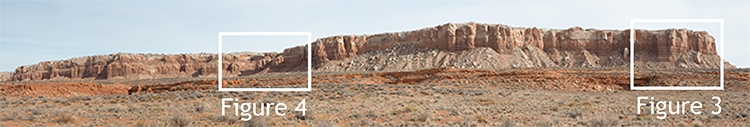
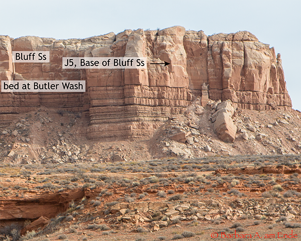
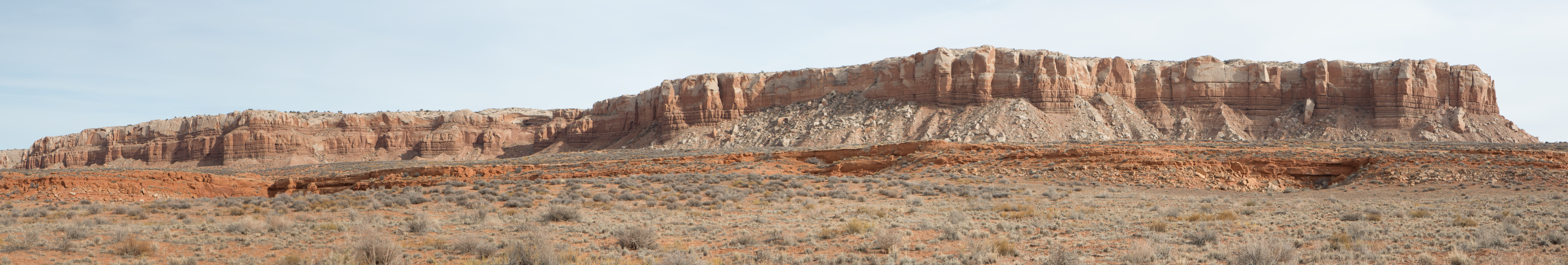
Figure 2 -- This is a panorama of the Bluff Ss and lower units just north of US Hwy 163 and just east of Comb Ridge. Below will be closer views of the outcrop to show more detail. Click HERE to see a larger view of Figure 2.
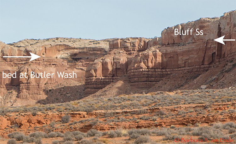
Figure 4 -- This is a closer view of the reentrant toward the left of the lower Butler Wash panorama in Figure 2. The base of the Bluff Ss is labeled with white arrows. At the very far right, the lower "bed at Butler Wash" looks contigous with the overlying Bluff Ss, but just to the left, it's apparent this is more complicated. According to O'Sullivan, the contact is the J5 unconformity and this interpretation is generally agreed by other researchers. It is not an intertonguing with the Bluff. The unit directly below the Bluff Ss is called either the Wanakah Fm or the Summerville Fm. References: Condon, S.M., 1989, Stratigraphic sections of the Middle Jurassic Wanakah Formation, Cow Springs Sandstone, and adjacent rocks from Bluff, Utah to Lupton, Arizona: U. S. Geological Survey Oil and Gas Investigations Chart OC-131. Gregory, H.E., 1938, The San Juan country, a geographic and geologic reconnaissance of southeastern Utah: U.S. Geological Survey Professional Paper 188, 123 p. Lucas, Spencer, R., 2014, Lithostratigraphy of the Jurassic San Rafael Group from Bluff to the Abajo Mountains, southeastern Utah: Stratigraphic relationships of the Bluff Sandstone, Volumina Jurassica, 2014, XII (2): 55–68 O'Sullivan, Robert B., 2010, The lower and upper contacts of the Upper Jurassic Bluff Sandstone Member of the Morrison Formation in southeastern, in: Geology of the Four Corners Country, Fassett, James E.; Zeigler, Kate E.; Lueth, Virgil W., [eds.], New Mexico Geological Society 61st Annual Fall Field Conference Guidebook, pp. 101-105. Pipiringos, G.N., and O’Sullivan, R.B., 1978, Principal unconformities in Triassic and Jurassic rocks, Western Interior United States – a preliminary survey: U.S. Geological Survey Professional Paper 1035-A, p. A1-A29. Turner, Christine E. and Peterson, Fred, 2010, Jurassic Rocks of the Four Corners Region, p. 1-23, in: Geology of the Four Corners Country, Fassett, James E.; Zeigler, Kate E.; Lueth, Virgil W., [eds.], New Mexico Geological Society 61st Annual Fall Field Conference Guidebook, pp. 101-105.
|